Blencathra Walk Guide and Information
Overview of Blencathra Walk:
At 868m above sea level, Blencathra is one of the highest peaks in the Lake District. This walk starts at approximately 150m above sea level in the Lakeland village of Threlkeld and approaches the summit via Doddick Fell. It is an exhilarating walk with superb views of most of Cumbria and northern England from the summit. Alfred Wainwright was intrigued by this mountain and gave it the most pages in all of his books: a staggering 36 pages! Blencathra is covered in Wainwright’s Book 5, “The Northern Fells” and the book is recommended to enhance your experience on of what he described as a mountaineers’ mountain. Click here to purchase this book.
Date Updated:
Recommended Map: Explorer OL5
| Difficulty Rating:
Steep Danger Rating: |
Time to complete: About 3.5 hours
Distance: About 8 km (5 miles) |
Car Parking/Walk Start:
The car park with toilets behind Threlkeld Public Rooms (on the main road through Threlkeld village centre close to the junction with Blease Road). |
| Refreshments:
Horse and Farrier Inn and The Salutation, both in Threlkeld. |
Wheelchair and Push Chair Suitability:
Not suitable. |
Public Transport:
X4 and X5 – Penrith/Workington/Cockermouth |

Blencathra Walk Description:
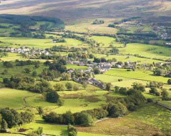
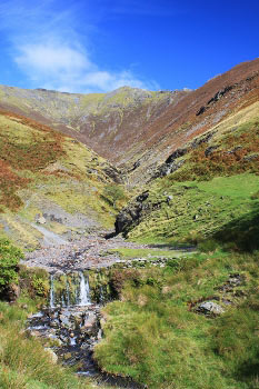 Take a right on leaving the car park and walk past Threlkeld Public Rooms. Take a left into Blease Road and within a few yards you turn right onto the gravelled lane, following the public footpath sign. You follow the lane as it goes past houses and swings to the left and down towards a footbridge over Kilnhow Beck.
You then cross several fields/minor becks always heading in a diagonal north easterly direction. You pass a lonely stone barn and continue always diagonally.
After going through the first of the farm buildings at Gategill (you may hear the sound of the Blencathra Hounds), you come to a junction of paths: follow the one on the left signposted for Gategill. Go through a gate on your right and proceed uphill with Gate Gill on your right.
You then get a spectacular sight of the mountain scenery which awaits you. After going through another gate you bear right to cross Gate Gill, just above a small waterfall.
Once over Gate Gill, ignore the path off to the left, which is for Hall’s Fell (the most popular route). Instead, pick up the path just to the left of the stone wall. After a section of level walking you then try to keep your feet dry crossing Doddick Gill. After crossing, take a left uphill and the path swings round to the right where you leave the Gill and follow a stone wall on your right. You don’t stay with the stone wall for long: you pick up the path on the left to start your steep ascent of Doddick Fell.
The path briefly levels off as you see the exhilarating sight of the full ridge path ahead towards the Doddick Fell Top. This is an exciting moment and a time to enjoy before you slog your way up the mountain. The distant traffic noise from the A66 starts to be replaced by the noise from Doddick Gill.
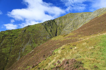
When you reach the Doddick Fell Top you see in the distance the many walkers climbing the notorious Sharp Edge, just above Scales Tarn. You may be pleased to know that our route to the summit is much more straightforward: from Doddick Fell Top we head upwards to the left in a westerly direction.
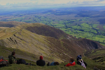
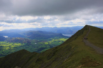
You soon get to the summit on Hall’s Fell. From here you can see the northern fells, the Solway Firth and Scottish Hills. To the east is the Pennines. To the South is Thirlmere and Derwentwater with most of Lakeland’s highest peaks in view; on a clear day you can see Morecambe Bay. If you can get some shelter from the wind it’s a great place to enjoy your picnic.
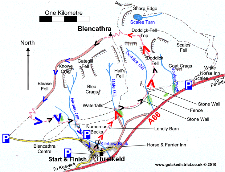
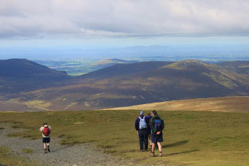
 From the summit: continue on the distinct footpath along the ridge in a south westerly direction towards Blease Fell and then to Keswick. After the path zig zags for a while the stone path ends and you have a choice of two paths on the grass: south west for Keswick or south east for Threlkeld. We head south east and after a steep downhill section the path splits again: bear east on the more distinct path towards Threlkeld. After a further section of steep descent you arrive at a stone wall; bear left and walk through a shallow unnamed beck.
Shortly afterwards you cross the more prominent Blease Gill and immediately after doing so, you take the gate in the stone wall on the right. You descend down to some steps and to a footbridge crossing back over Blease Gill. Proceed through a car parking area and back down to the village on the tarmac road. At the bottom of Blease Road turn right back to the car park, or left for The Salutation!
Rate This Walk
User Review
( votes)0 = worst; 1 = disappointing; 2 = average; 3 = a really good walk; 4 = I recommend this walk; 5 = one of the best walks I’ve done
| Here’s a selection of products you might find useful in this area of the Lakes: |
Whilst we try our very best to ensure the accuracy of this information, we accept no liability for anyone getting lost or injured. You should always consult your ordnance survey map for exact details and wear appropriate clothing for the weather conditions.
