Date Updated:
Recommended Map: Explorer OL4
| Difficulty Rating:
Danger Rating: |
Time to complete: About 5.5 hours
Distance: About 15.5 km (10 miles) |
Car Parking/Walk Start:
Around Skelgill, near Hawes End; or in Keswick (if using the Keswick Launch boat service). |
Overview of Walk:
If you have an opportunity to do only one long walk in the Lake District then this classic would have to be on your short list. Climbing up to Catbells (451m) you continue your ascent to High Spy (653m) and Dale Head (753m), returning via Hindscarth (727m).
There are glorious high mountain views in all directions and of three lakes: Derwentwater, Bassenthwaite Lake and Buttermere.
The distance should not be underestimated but there are several escape routes should you get into difficulty. A great day out of straightforward hill walking, but your body will be aching the next the day!
| Refreshments:
None en route; picnic essential. |
Wheelchair and Push Chair Suitability:
Not suitable. |
Public Transport:
Bus Service 77/77A Honister Rambler, or catch the Keswick Launch from Keswick to Hawes End. |

Catbells and the Dale Head Horseshoe Walk Description:
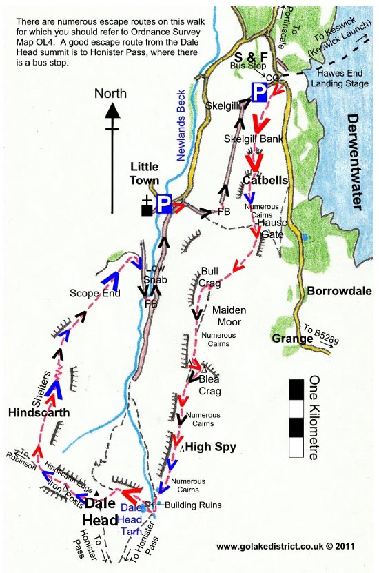
The walk starts from the bus stop, next to the cattle grid, near the car parking area underneath Skelgill Bank. Proceed upwards through the gate. You soon cross over the road and pick up the path going up Skelgill Bank, with your first glimpse of Derwentwater on your left. Within about 30 yards take the path on your right going uphill steeply.
You will need to use your hands going up Skelgill Bank but the going is straightforward. I think the best views are to be had here so don’t rush off as the outlook behind you is simply stunning!
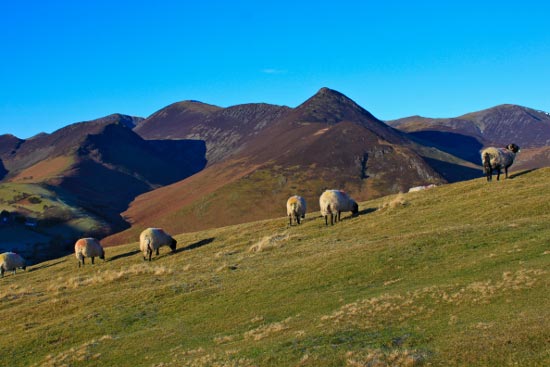
Proceed onwards and upwards to the distinctive slopes of Catbells. If it’s a summer weekend you will be trudging up like an army of worker ants on what looks like a giant sized ant hill. In contrast, on a weekday in winter you may, surprisingly, have it all to yourself!

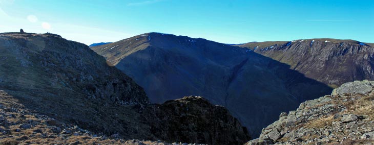
 Descend from Catbells in a southerly direction. Ignore the escape paths off on the left and right and start climbing uphill in a southerly direction towards Bull Crag. Although advisable to avoid Bull Crag in mist, in clear conditions it does provide you with your first glimpse of Dale Head and the return route (for much later in the day!).
As you go over Maiden Moor the going is much easier and you are able to pick up a bit of speed. A couple of yards before a prominent cairn, take the distinct path on your left, climbing to the impressive cairn on Blea Crag.
From Blea Crag descend diagnolly to the right to rejoin the main path.
When you rejoin the main path you now have a good view of Dale Head and start climbing towards the tall cairn/monument on High Spy. If you have sore feet this will test them, as it isn’t pleasant walking on the sharp edged rocks sticking out of the ground.
Descend to Dale Head Tarn, passing smaller tarns en route. After crossing the beck you need to briefly ascend to Dale Head Tarn.
Dale Head Tarn is a good place for a picnic as there’s not many places offering any shelter on this walk. It’s usually windy on the summit of Dale Head.
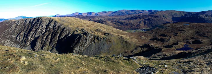
Walk around Dale Head Tarn, through the ruined mine building and head uphill very steeply on a paved path which becomes steps. Towards your left you have a good view towards Scafell Pike and the surrounding mountains. It’s at times like this I regret eating too many pies over the years – pheeew, it is steep going!
When the steps end you get a good view of the valley below and an escape path. However, we continue upwards to the impressive summit cairn on Dale Head, where it has a surprisingly commanding position in the middle of higher mountains.
From Dale Head, descend along Hindscarth Edge with views of Buttermere opening up to the left. Take the path on the right heading uphill in a northerly direction towards Hindscarth. At first you think you can see a summit cairn, but like a mirage it isn’t (it’s actually a rock where walkers have put a few stones on top to give the illusion of a cairn).
Keep going uphill to the first of two shelters on Hindscarth. From here, you have superb views of the valley to the left and the western fells. From the second shelter, it descends steeply as you zig zag downhill.
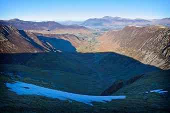 The path levels and drops several times. You will need to use your hands again as you get closer to the valley.
The path turns back on itself as you descend above the farm below. From the farm at Low Snab, follow the public footpath sign for “Dale Head / Little Town”, take a left over the footbridge. Once over the bridge take a left.
This area still shows the scars of former mining activity in the area, but this doesn’t detract from the fantastic scenery.
As you walk along the track, watch out for the church down to the left because as you draw level with it, take the path on the right heading up following a stone wall on the left. As it swings round to the right it levels off.
Turn left after the footbridge as you walk underneath Skelgill Bank which you were on earlier in the day.
Stay on the main path until you reach a surfaced lane where you turn right back to the car park / bus stop / Keswick Launch jetty.
Points of interest: There is a monument stone on Skelgill Bank to Thomas Arthur Leonard, founder of co-operative and communal holidays and father of the open air movement in this country. Born London 1864, died Conway 1948, believing that “the best things any mortal hath are those which every mortal shares”.
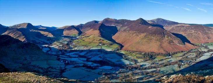
User Review
( votes)0 = worst; 1 = disappointing; 2 = average; 3 = a really good walk; 4 = I recommend this walk; 5 = one of the best walks I’ve done
Whilst we try our very best to ensure the accuracy of this information, we accept no liability for anyone getting lost or injured. You should always consult your ordnance survey map for exact details and wear appropriate clothing for the weather conditions.
