Scafell Pike – Walk Guide

Submitted:31Aug10
Date Updated:
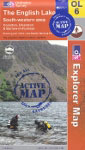
Recommended Map: Explorer OL6
Free Postage & Packaging – Buy here to support our Free Walk Guides.
The updated version even includes a mobile download with the map.
| Difficulty Rating:
Hard Danger Rating: See below |
Time to complete: About 6 hours
Distance: About 14 km (9 miles) |
Car Parking/Walk Start:
There is road side car parking on the road leading to Seathwaite. |
Overview of Scafell Pike Walk:
At 978m, Scafell Pike is England’s highest mountain. All fell walkers will want to do this walk simply to stand on top of England. This route to the summit is not the shortest or longest, but possibly the best route on well defined paths throughout.
Danger Rating: This walk is best done when you have a really good weather forecast. It’s best avoided if there’s any chance of rain as you won’t see a thing from the summit. It is important that you ensure that you allow three hours of daylight to get back down from the summit. You do not want to be another mountain rescue statistic or newspaper story; nor should you put other lives in danger trying to rescue you.
| Refreshments:
None en route; however, there are numerous establishments in the Borrowdale Valley. |
Wheelchair and Push Chair Suitability:
Unsuitable. |
Public Transport:
None to Seathwaite but there is to Seatoller: 77/77A – Keswick/Lorton; or 78 – Keswick/Seatoller |
Walk Description:
Why bother trying to describe Scafell Pike and the many routes to the summit when the great man devotes 30 superb pages to it. Alfred Wainwright’s Pictorial Guide to the Lakeland Fells, Book Four, revised by Chris Jesty in 2007/08, gives an essential guide and account of all the possible routes to Scafell Pike and the surrounding fells. It is strongly advisable not to tackle this walk without it. Click on this link to purchase the updated version of it. This description of the route from the Borrowdale Valley comes nowhere near Wainwright’s comprehensive account.
Additionally, the level of detail shown on the following map cannot replace the Ordnance Survey map, which you should ensure that you have. Ordnance Survey map OL6 covers the walk from Stockley Bridge to the summit (OL4 shows the route from Seathwaite to Stockley Bridge but you could tackle the walk without this map as this part of the walk is straightforward.)

From the car parking area at the side of road, proceed through the Seathwaite Farmyard, following the sign to Esk Hause, on the wide surfaced path. As you walk through the valley you can see ahead that you have a full day’s walking in store.
After 20 minutes you reach Stockley Bridge: proceed over and once through the gate, take the well defined narrow path on your left which at first follows a dry stone wall located on your left.
As I walk up the path, I find it interesting that Wainwright’s achievement was even more marvellous considering he didn’t drive. He must have had many a long day (and night) on the fells.
After a while you go over a footbridge and start to feel that you are going uphill proper.

The path briefly levels as you cross over Ruddy Gill underneath the rock face of ‘Great End’. Once over the Gill bear left and continue on uphill (for information only: the path on the right goes to Sprinkling Tarn). Shortly afterwards, bear right onto the most defined path continuing uphill. The reward is a fine view behind you of Derwentwater, Sprinkling Tarn and the surrounding fells.
At a junction you have a choice to go down to the left in an easterly direction or up to the right in a westerly direction towards the side of Great End; go up to the right. The most prominent fell in view as you ascend is Ill Crag (located towards the left of the horizon). You can’t actually see the summit of Scafell Pike yet!
You eventually come to a hard uphill section walking on boulders, which should present no problem in dry weather. On completion, your reward is the first glimpse of the summit of Scafell Pike and one of its many shelters.
You then have a section of downhill walking on a longer section of boulders, followed by the final and steepest section of rocky uphill walking.
Hopefully you will have clear weather to enjoy some time on the summit. Wainwright’s Book Four labels everything you can see on your 360 degrees panorama view.

 From the summit descend in a north westerly direction to a prominent cairn, with Wastwater slightly to the left of you.
A good landmark is a wall on the slopes of Lingmell. As you get nearer to it you need to take a path off to the right (at the point just before the path swings round sharply to the left). You then see a couple of small tarns.
After crossing the unmistakeable ravine of Piers Gill, you soon get to the ravine of Greta Gill where greater care should be taken to stay to the footpath to avoid any unpleasant falls.
As you approach Sty Head Tarn you come to a mountain rescue stretcher box, which hopefully will not be needed! At the stretcher box take a hard right passing the tarn. Five minutes after the passing the tarn (on your right), use the footbridge to cross over Sty Head Gill. You make your final section of descent before seeing the welcome landmark of Stockley Bridge. From here retrace your steps back to Seathwaite.
Although this will never be the prettiest Lake District walk, you can complete it with the satisfaction that you have stood on the highest ground in England.


Rate This Walk
User Review
( votes)0 = worst; 1 = disappointing; 2 = average; 3 = a really good walk; 4 = I recommend this walk; 5 = one of the best walks I’ve done
| Here’s a selection of products you might find useful in this area of the Lakes: |

Whilst we try our very best to ensure the accuracy of this information, we accept no liability for anyone getting lost or injured. You should always consult your ordnance survey map for exact details and wear appropriate clothing for the weather conditions.